Bribie Island 4WD Beach & Bunker Tour


Bribie Island Beach & Bunker 4WD Tour: A Journey Through Nature and History
🌊 Experience the Wild Beauty & Wartime Past of Bribie Island 🌿
Quick Details
- Duration: 2.5 – 3.5 hours
- Tour Type: Guided 4WD adventure Beach & history tour
- Meeting Location: 140 North St, Woorim, Bribie Island Free public car parking area (A detailed map will be sent with your booking confirmation.) or follow this link to view https://maps.app.goo.gl/uoREAAfm3E6yoHSe6
- Inclusions:
✔ Professional Driver & Guide
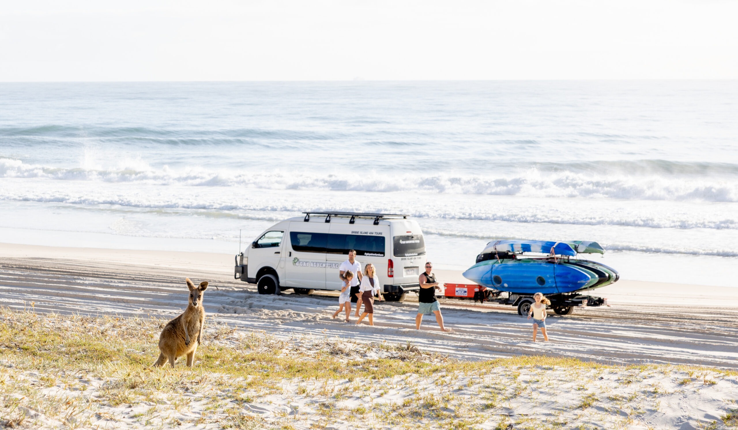
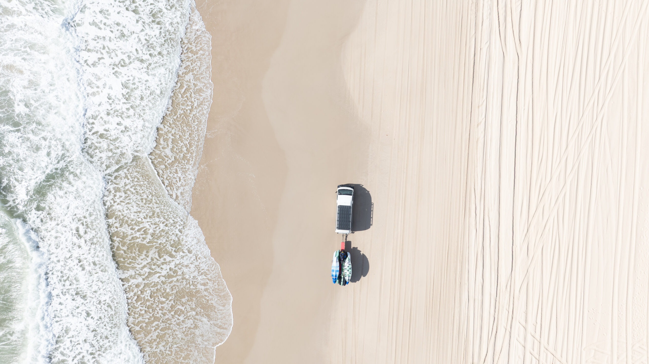
✔ 4WD Tour of Bribie Beach
✔ Photo Opportunities of Native Wildlife
✔ Visit Tea-Tree Lagoons (Swimming Optional)
✔ Explore WWII Fort Bribie Bunkers
✔ Learn the History of Bribie Island
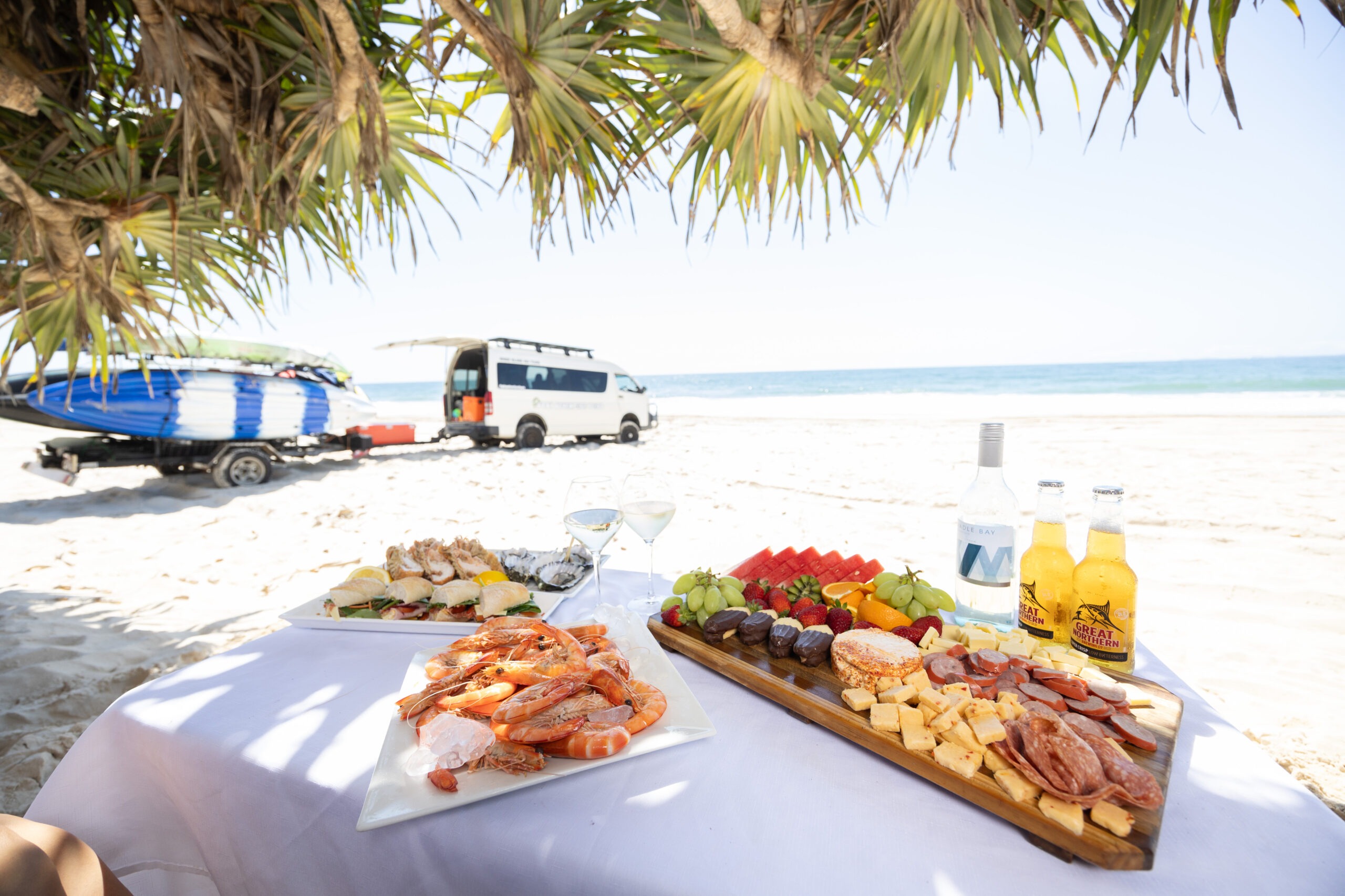
✔ Water & Snacks
Tour Highlights
✔ 4WD Off-Road Adventure – Journey through Bribie Island’s rugged landscapes, from sandy beaches to hidden lagoons.
✔ Historic WWII Bunkers – Explore the WWII coastal defense fortifications at Fort Bribie.
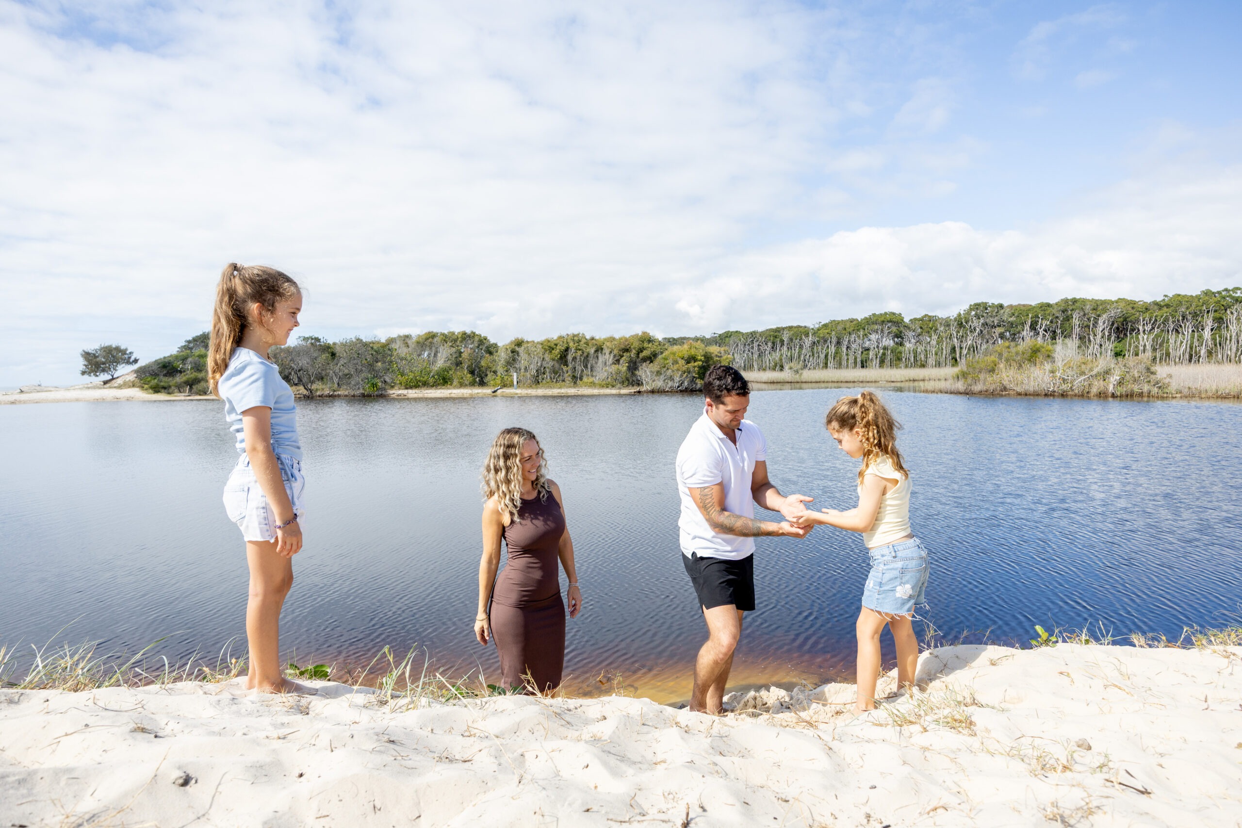
✔ Swim in Tea-Tree Lagoons – Enjoy a refreshing swim in Bribie’s unique naturally stained lagoons. (Let the guide know if you want to swim)
✔ Scenic Coastal Views – Drive along the pristine coastline, taking in the breathtaking ocean scenery.
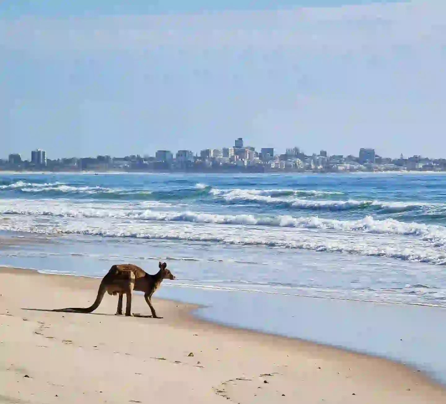
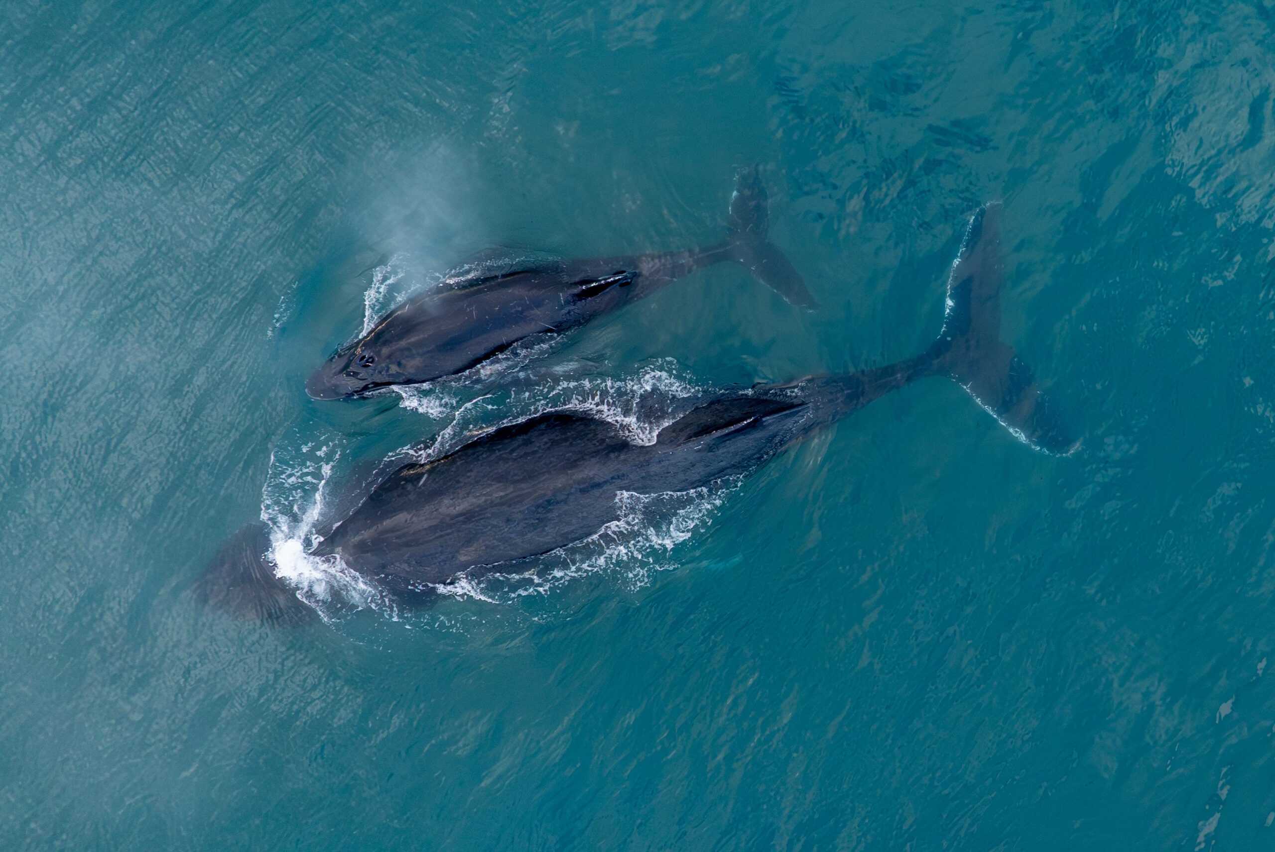
✔ Wildlife Spotting – Keep an eye out for kangaroos, sea eagles, goannas, and even dolphins playing in the waves.
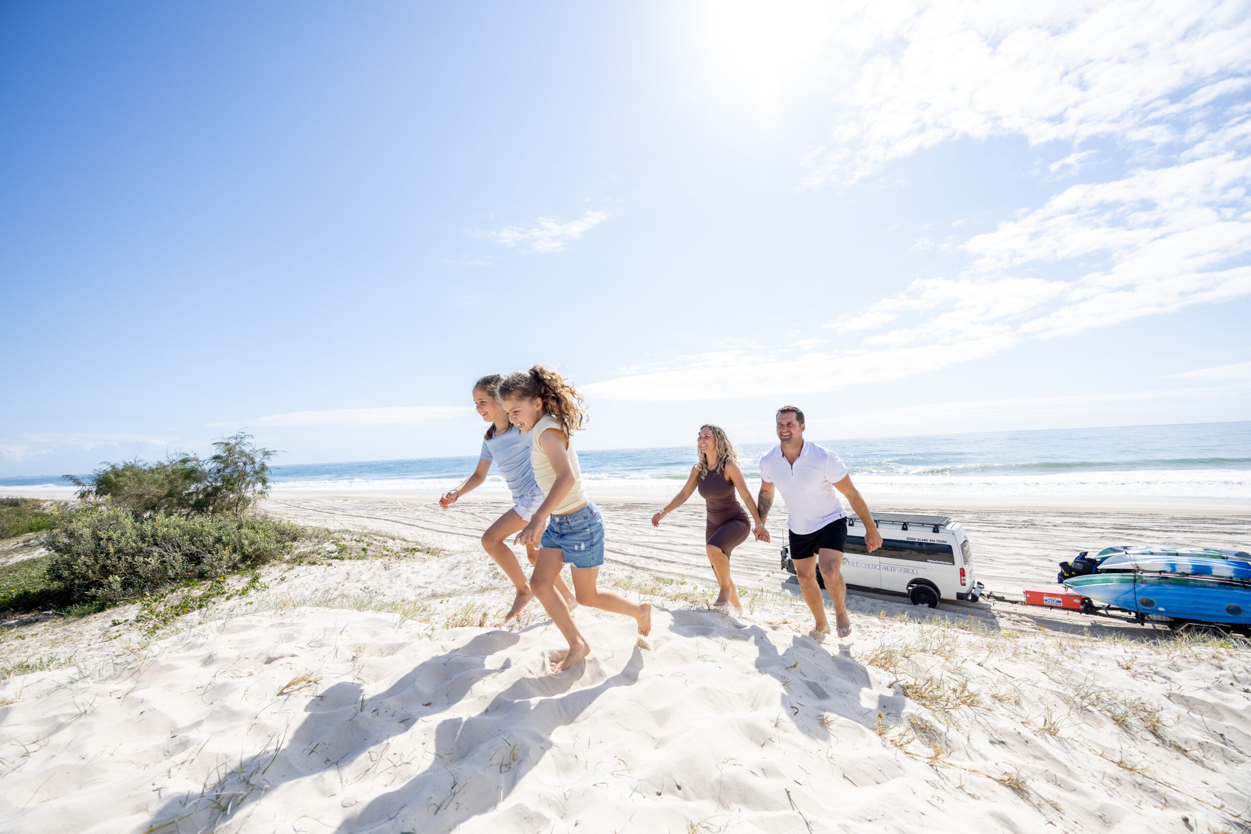
✔ Small Group Experience – Enjoy a personalized tour in an exclusive 4WD adventure van.
What to Expect on Your Bribie Island Adventure
1️⃣ Start Your Journey: Beach Access Track to Norfolk Lagoon
Your adventure begins as you hop into a custom-built 4WD van and head into the Bribie Island National Park. Driving through the beach access track at Woorim, the journey immediately immerses you in the island’s raw, untouched beauty.
🌿 First Stop: Norfolk Lagoon
- A tranquil natural haven, perfect for photography.
- Enjoy breathtaking views of the surrounding bushland and coastal flora.
- Spot native birds and other wildlife in this peaceful environment.
- Swimming optional
2️⃣ Welsby Lagoon: A Scenic Coastal Stop
The tour continues north along Bribie’s pristine beaches to reach Welsby Lagoon, an ideal location to:
- Stretch your legs and take in the serene atmosphere.
- Snap stunning landscape photos of the shimmering water.
- Observe local birdlife and coastal ecosystems.
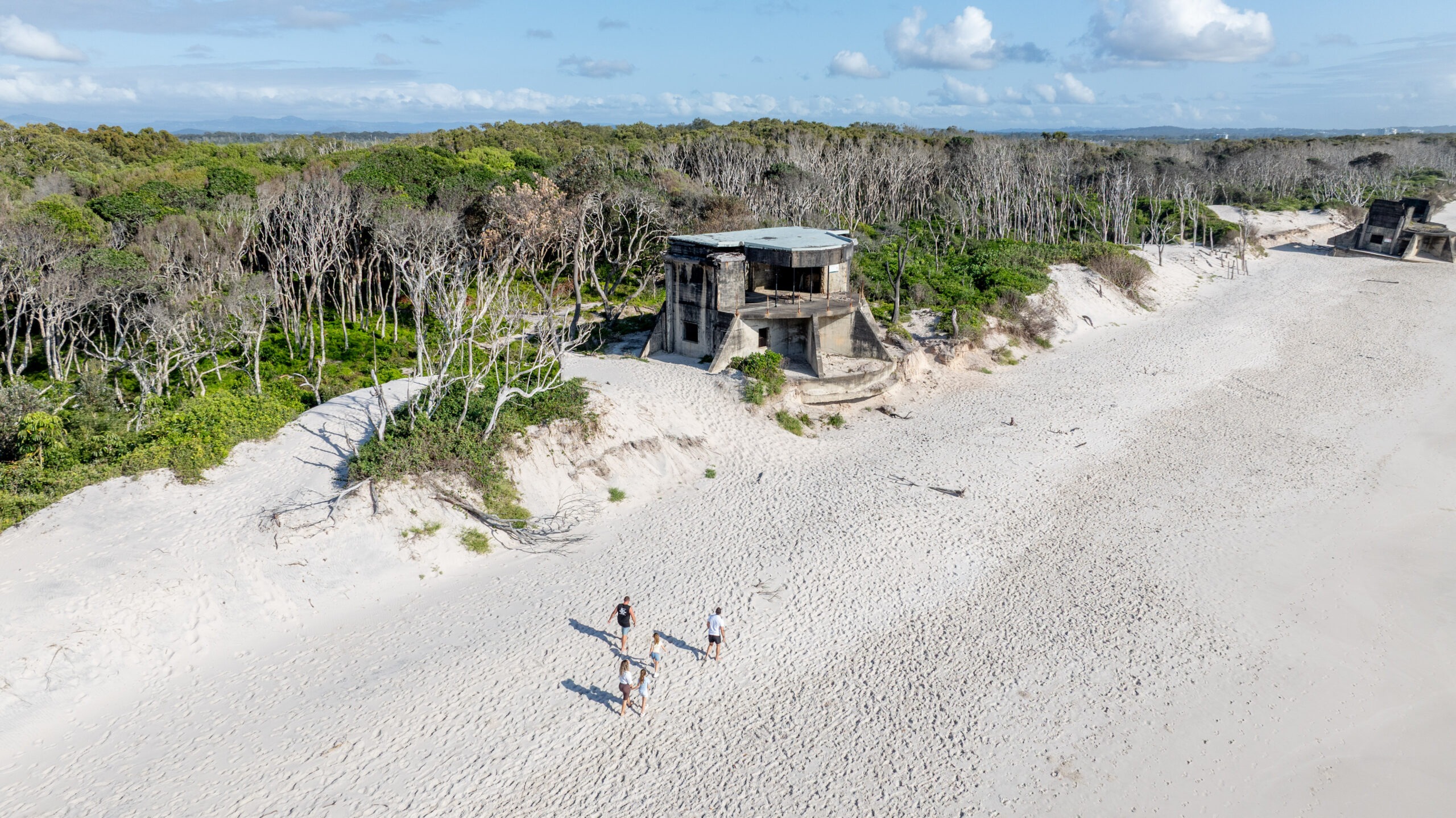
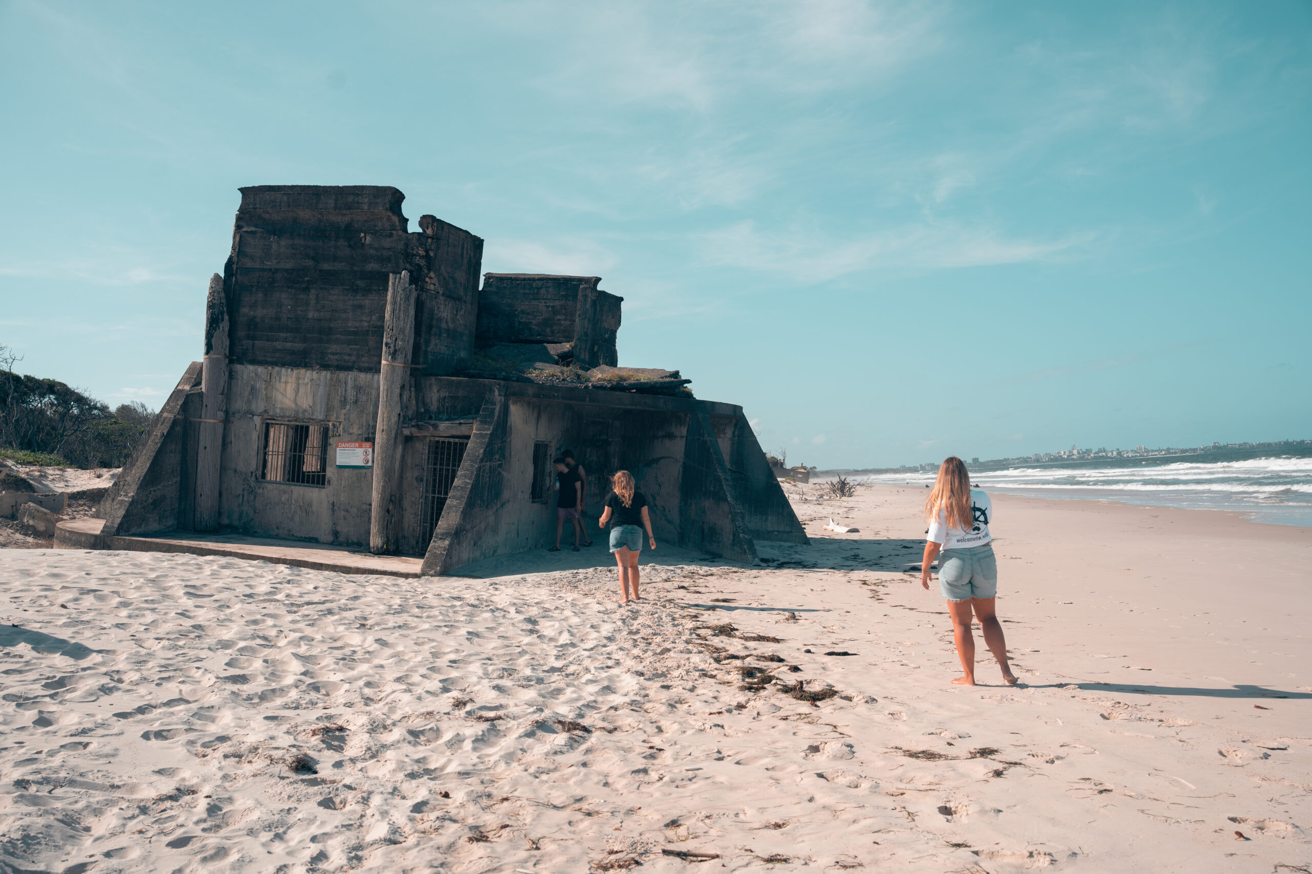
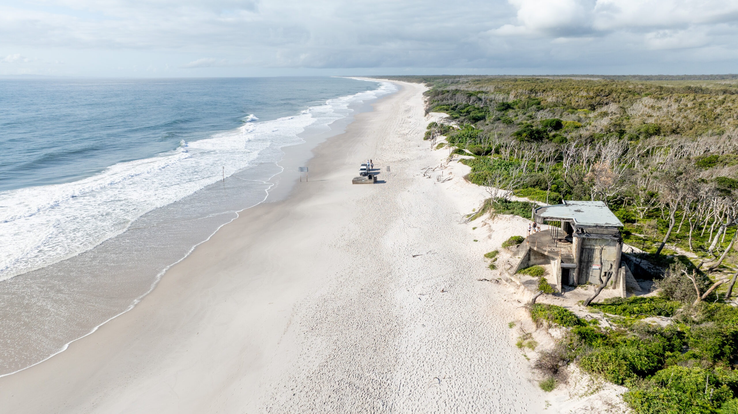
3️⃣ WWII Bunkers at Fort Bribie: A Step Back in Time
From Welsby Lagoon, the adventure leads to Fort Bribie, one of Queensland’s significant WWII historical sites.
🏰 Exploring the WWII Bunkers
- Discover coastal defense structures built in the 1940s.
- Learn about the fort’s role in protecting Australia during wartime.
- Walk through concrete bunkers and gun emplacements, slowly being reclaimed by the sea.
📖 Historical Insights from Your Guide
Your expert guide will share fascinating stories about:
- The soldiers who served at Fort Bribie.
- The importance of the bunkers in Australia’s coastal defense.
- How the island’s natural landscape played a role in military strategy.
4️⃣ Wildlife Watching & Coastal Views on the Return Drive
As the tour begins its return south along the coastline, enjoy the spectacular ocean views while keeping an eye out for:
🐬 Dolphins – Often seen playing in the waves near shore.
🦘 Kangaroos – Grazing in open grasslands.
🦅 Sea Eagles & Ospreys – Soaring high above.
🦎 Goannas – Basking in the sun.
🐋 Whales (Seasonal: August – November) – Keep an eye out for humpback whales breaching as they migrate along the coast.
🐢 Baby Turtles (Seasonal: January – April) – During nesting season, it is sometimes possible to spot tiny hatchlings making their way to the ocean.
🎥 Photo Opportunities – This part of the journey is perfect for capturing stunning coastal landscapes and incredible wildlife sightings.
5️⃣ Return to the Pickup Point
After an action-packed and historically rich tour, your 4WD will take you back to the starting point at Woorim.
By the end of the experience, you’ll have:
✔ Explored some of Bribie Island’s most scenic locations
✔ Learned about its fascinating WWII history
✔ Spotted incredible wildlife
✔ Captured breathtaking photos
Why Choose the Bribie Island Beach & Bunker Tour?
1️⃣ A Unique Blend of Adventure & History
🌿 4WD through Bribie’s National Park, swim in lagoons, and explore WWII relics—all in one tour!
2️⃣ Perfect for Nature Lovers
📸 Whether it’s Norfolk Lagoon, Welsby Lagoon, or ocean views, there’s no shortage of breathtaking scenery.
3️⃣ A Rare Look into WWII History
🏰 Fort Bribie’s wartime bunkers are a must-see for history enthusiasts. Each visit is unique as the elements continue to reshape these relics.
4️⃣ Small Group, Family-Friendly Experience
👨👩👧👦 This tour is ideal for families, solo travelers, and groups of all ages.
What’s Included?
✅ Professional Guide & Driver – Engaging storytelling & expert navigation.
✅ Comfortable 4WD Transport – Designed for beach & off-road travel.
✅ WWII Bunker & History Tour – Learn about Fort Bribie’s wartime past.
✅ Nature Stops at Stunning Lagoons – Optional swimming & wildlife spotting.
✅ Wildlife Viewing Opportunities – Dolphins, sea eagles, kangaroos, goannas, and more.
✅ Water & Snacks Provided – Stay hydrated and energized throughout the tour.
What to Bring?
🎒 Comfortable clothing & footwear
🩱 Wear your Swimwear & bring a towel (for lagoon swim)
🧢 Hat, sunscreen & sunglasses
📸 Camera (for wildlife & landscape shots)
💧 Reusable water bottle
Frequently asked question
WWII Bunkers
The WWII bunkers on Bribie Island, collectively known as “Fort Bribie,” are a significant historical site located along the northern end of Bribie Island’s surf beach. Constructed between 1939 and 1943, these bunkers were part of the broader South East Queensland military defense strategy during World War II.
The fortifications include 11 concrete bunkers designed to protect against potential naval threats and provide strategic military defense.
In addition to the bunkers, local legend suggests the existence of an underground hospital built during the same period. This secretive facility was reportedly constructed to provide medical care and support during the war. However, it has since been covered over and remains hidden, adding an element of mystery to the site’s history.
Today, these WWII bunkers offer a fascinating glimpse into Bribie Island’s wartime past and attract visitors interested in military history and heritage. The site serves as a poignant reminder of the island’s role in the defense of Australia during the global conflict.
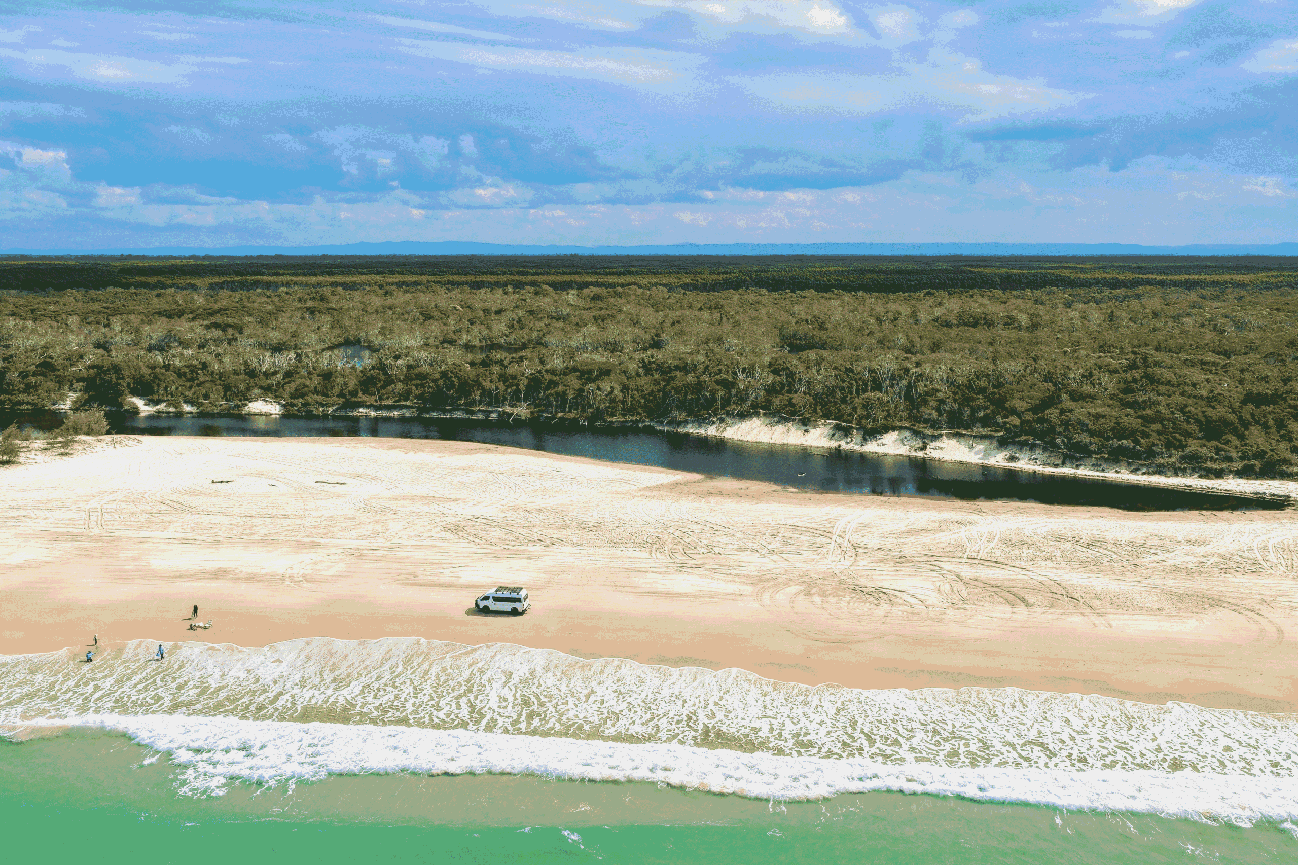
Norfolk Lagoon
Bribie Island hosts 4 semi-tidal lagoons. Fresh water Creek, Norfolk Lagoon, Mermaid Lagoon & Welsby Lagoon.
The Tee Tree Stained Lagoons on Bribie Island are a remarkable natural feature known for their unique, tea-coloured waters. This colouration comes from the tannins leached from the surrounding melaleuca (tea tree) forests, which give the lagoons their distinctive dark hue. These lagoons are part of the island’s diverse wetland ecosystem and are surrounded by lush, vibrant vegetation.
Visitors to Bribie Island often find the stained lagoons intriguing because the dark waters contrast strikingly with the bright, clear skies. The lagoons offer a tranquil setting, making them popular spots for relaxation, birdwatching, and photography. The surrounding areas provide opportunities for bushwalking and observing the rich flora and fauna of the island. The natural beauty and ecological significance of the Tee Tree Stained Lagoons make them a special highlight of Bribie Island.
When these lagoons finally break open, it is quite the sight as these golden-brown waters spill over and rush down to the crystal blue ocean water. This makes quite an exciting 4WD experience when crossing from one side of the break to the other.
Other Things to Do on Bribie Island After a 4WD Beach and Bunker Tour
Bribie Island is a hidden gem just an hour’s drive from Brisbane, offering a perfect mix of adventure, relaxation, and unique experiences. If you’ve just finished an exhilarating 3-hour 4WD beach and bunker tour with G’Day Adventure Tours, don’t pack up and leave just yet! There’s plenty more to explore on this beautiful island. From cruising on a gondola to visiting local attractions, here are some other must-do activities to round out your day on Bribie Island.
1. Take a Ride on the Bribie Island Gondola
After the adrenaline rush of a 4WD tour, why not switch gears and relax on a peaceful gondola ride? The Bribie Island Gondola offers a tranquil and romantic experience as you glide along the serene Pumicestone Passage. Whether you’re with a loved one or just want to enjoy a relaxing moment on the water, this gondola ride is the perfect way to take in the island’s natural beauty from a different perspective.
Why It’s Worth Trying:
- Enjoy a calm, scenic view of the island and its wildlife.
- Perfect for couples, or small groups 6 max looking for a quiet moment.
- You can even book a special sunset cruise for an extra magical experience.
If you’re a nature lover, a visit to the Bribie Island Butterfly House is an enchanting way to spend part of your day. The Butterfly House is home to hundreds of colorful butterflies in a beautifully designed enclosure that mimics their natural habitat. Wander through the gardens and watch these delicate creatures flutter around you. It’s a peaceful and educational stop that will captivate both adults and children alike.
Highlights of the Butterfly House:
- Learn about the life cycle of butterflies from egg to adult.
- Explore the lush, garden-like setting that the butterflies call home.
- Great photo opportunities with vibrant and unique butterfly species.
3. Rent a Fishing Boat or Kayak
For those who love being on the water, renting a fishing boat or kayak is a fantastic option for the afternoon. Bribie Island offers calm waters, making it an ideal spot to cast a line and try your hand at fishing, or simply paddle around and soak in the sights. Many local businesses offer boat and kayak rentals for a few hours or a full day, making it a flexible and fun activity.
Reasons to Rent a Boat or Kayak:
- Perfect for both beginners and experienced adventurers.
- Enjoy the peaceful waters of the Pumicestone Passage.
- A great way to explore hidden spots, mangroves, and the diverse marine life around the island.
4. Grab a Bite to Eat Near the Jetty
After working up an appetite, head over to the Bribie Island Jetty where you’ll find several eateries offering delicious meals with a side of ocean views. Whether you’re craving seafood, burgers, or a light snack, you’ll find something to satisfy your hunger. Popular spots around the jetty include beachside cafés and seafood restaurants where you can sit back, relax, and enjoy the laid-back island vibe.
Top Recommendations for Dining Near the Jetty:
- Savige’s Seafood: A local favorite known for its fresh fish and chips.
- The Jetty: Perfect for a delicious meal or drink with beautiful waterfront views.
- Annie Lane cafe: A great spot to grab a drink and a meal while soaking in panoramic views of the beach.
5. Visit the Bribie Island Seaside Museum
For a bit of history and culture, make a stop at the Bribie Island Seaside Museum. This quaint museum provides insight into the island’s rich history, including its significance during World War II, when it housed military bunkers. You can explore fascinating exhibits covering the island’s Indigenous heritage, early settlement, and natural environment. It’s a relaxing way to wind down your day while learning more about Bribie Island’s past.
Why You Should Visit the Seaside Museum:
- Discover the island’s connection to Australia’s wartime history.
- Learn about local Indigenous culture and early explorers.
- Perfect for those looking to add an educational element to their day.
Bonus Activities for the Ultimate Day on Bribie Island
If you still have time and energy left, consider adding one of these bonus activities to your itinerary:
- Walk the Bicentennial Gardens: A peaceful place for a stroll, these gardens are full of local flora and fauna.
- Explore Woorim Beach: This stretch of beach is perfect for a late afternoon swim or walk along the shoreline.
Conclusion – A Full Day of Adventure and Relaxation on Bribie Island
Bribie Island offers a wide range of activities that make it an excellent destination for a day trip from Brisbane. After an exciting 3-hour 4WD beach and bunker tour with G’Day Adventure Tours, there are still plenty of ways to enjoy the island’s natural beauty, cultural attractions, and delicious dining spots. Whether you’re exploring by boat, strolling through a butterfly sanctuary, or learning about the island’s history, Bribie Island has something for everyone. Make the most of your day trip by combining adventure, relaxation, and discovery on this beautiful island getaway.
FAQs
1. Can I combine the 4WD tour with other activities on Bribie Island in one day?
Yes! After your 3-hour 4WD tour, you can easily fit in other activities like a gondola ride, a visit to the Butterfly House, or a trip to the Seaside Museum.
2. How do I book the Bribie Island gondola or rent a kayak?
You can book the Bribie Island Gondola online or through local tour operators. Kayaks and boats can be rented from local vendors or via websites that offer rental services.
3. Is the Butterfly House suitable for children?
Absolutely! The Butterfly House is family-friendly, offering an educational and fun experience for kids and adults alike.
4. What’s the best time to visit Bribie Island?
Bribie Island is great to visit year-round, but the cooler months (April to October) offer perfect weather for outdoor activities.
5. Are there accommodation options if I want to stay overnight?
Yes, Bribie Island has a variety of accommodation options, from beachfront resorts to cozy holiday homes, if you want to extend your stay beyond a day trip.